Most Upper Valley communities avoid flooding amid rain, snowmelt
| Published: 03-17-2025 4:45 PM |
CANAAN — Rain and snowmelt combined to lead the National Weather Service to issue a flood watch across the Upper Valley through Monday evening.
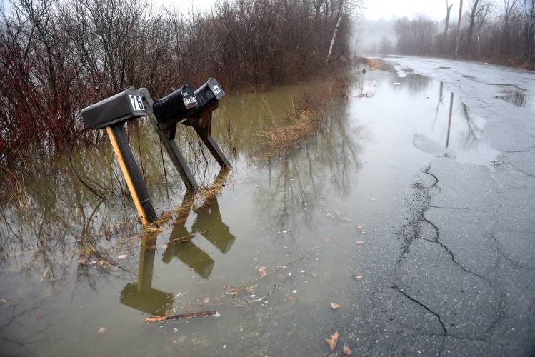
In response, officials monitored river levels and restricted access to some roads, but, in most areas, predicted impacts did not pan out.
In West Lebanon, the Fire Department monitored the Connecticut River, which was expected to near its capacity Monday around 8 p.m.
But, the river looked to be reaching peak levels by about midday, mitigating concerns, National Oceanic and Atmospheric Administration meteorologist Stephen Baron said Monday.
Monday’s storm could also mean the end of snowmelt-driven flood risk this season because so much snow was melted by the latest rain, Baron said. The storm was “really the event where we were concerned about snowmelt contributing to the river rises.”
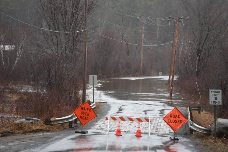
In response to rising waters in the Indian River, Canaan officials closed Potato Road Monday, according to a news release from the town. The road has been prone to flooding in the past.
Canaan Police also monitored other flood-prone areas Monday, including South Road, which “typically will be the next road to flood” after Potato Road. South Road was still open as of Monday at 1 p.m, Police Chief Ryan Porter said.
“There is a lot of water in the woods and in the fields surrounding that area, so I would anticipate that that will flood at some point,” Porter said.
Article continues after...
Yesterday's Most Read Articles
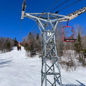
 As spring skiing season winds down, one NH ski area plans to spin its lift until May
 Newbury,Vt., man who killed daughter ruled to be ‘not guilty by reason of insanity’
 Kenyon: The true cost of lawsuit for Dartmouth Health
 Editorial: Free speech detentions reach into Upper Valley
 Protesters rally in Lebanon and elsewhere across the country
 ECFiber and operating company trade legal blows as contract renewal talks break down
In Lyme, a notice on the town website warned of washouts and announced that “the Town dirt section” of Dorchester Road and Grafton Turnpike was restricted to local traffic as of Monday at about noon.
In Tunbridge, Emergency Management Director Brenda Field was out monitoring rivers Monday and said she saw “high water,” but nothing else “other than mud.”
The town’s road crew was out managing Tunbridge’s many dirt roads “doing their usual battling of mud season,” Field said.
Tunbridge has 14 miles of paved roads and 78 miles of dirt roads, according to a 2022 Vermont Agency of Transportation report. The town’s difficult mud seasons are well documented.
The Ottauquechee River near West Bridgewater reached a “minor” flood level early Monday morning, according to the National Weather Service. But, Fire Chief Ed Earle said he was not aware of any actual flooding in town as of midday Monday.
As flood season dawns, Bethel-based company, Transcend Engineering, has released a new app to help track rivers and flood risk.
“I think for a lot of folks, it’s kind of mysterious,” Emily Ellert, digital strategies manager for Transcend, said in a recent interview. “We were looking to build something that was a little more user friendly and easy to understand, especially given the damage that has occurred in our community over the past few years.”
The RiverAware flood app shows river heights at U.S. Geological Survey stream monitoring stations across the country and color codes them based on flood level. Users can set alerts for certain monitoring stations.
The app can only be downloaded only on the Apple App Store. There are other flood alert apps available, but Ellert said she believes RiverAware is more “user friendly” because of it’s color coded pins and some features. The app also sends notifications with real-time data that can be shared with others and has some free functions, unlike many other apps.
Clare Shanahan can be reached at cshanahan@vnews.com or 603-727-3216.


 On the trail: Gov. Ayotte says she delivered on her promises in her 100 days in office. Not everyone agrees
 Windsor snow globe business fears Trump tariffs
 Fill ’er up: New Hampshire considers allowing patrons to pour their own alcohol
  School Notes: Red Sox honor longtime Thetford Academy educator Ted Peters
